Bekal Fort is one of the largest preserved forts in Kasargod district of Kerala. The fort gets its uniqueness quotient from its exotic structure, which is shaped in the form of a keyhole. It was exclusively meant for the purpose of providing defense to the territory. Bekal Fort is prominent, because unlike most of the Indian forts, this monument does not have a palace or a mansion. For that matter, even the remains of any such structure cannot be found in Bekal Fort. The holes which are made on the outer walls of the structure are specially designed, so that the fort could be defended in case of a war. The holes on top are designed to aim at the farthest enemy, while the holes which are lower on the wall are for striking when the enemy is approaching. This shows how much time and hard work was spent in forming the design of the Fort. During Kolathiri kingdom's reign, Vekkolath Fort was identified by a number of scholars as the Bekal Fort. It is supposed that later the Bednore rulers rebuilt the fort and heavy renovations were done to improve it. Bekal Fort has supposedly served the Nayakas in establishing their dominance in the then called Malabar region. Later, the Nayakas found out the economic importance of the port and hence, they fortified the Bekal Fort subsequently.
The renovations of Bekal Fort were started during the reign of Hiriya Venkatappa Nayaka. The renovations were finished during the period of Shivappa Nayaka - both of these rulers were of the Nayaka clan. The Nayakas needed the speedy completion of Bekal Fort's construction, so that they could use it for the defense of the port and also to curb any other overseas attack on the Malabar territory. For the same reasons, Chandragiri Fort was also erected by the Nayakas.
Later on, Bekal Fort came under the majestic Tippu Sultan when he led a great military expedition to add the Malabar to his territory. Excavations were done in and near Bekal Fort, which led to the discovery of a number of coins and other artifacts that support the fact that the Bekal fort remained under the rule of a number of Sultans of Mysore. After the death of Tippu at the Anglo-Mysore war, the Fort came under the influence of British East India Company. Nowadays, the protection and maintenance has been undertaken by the Archaeological Survey of India.The main attraction of Bekal fort is its architecture. The Fort has been constructed, keeping in mind its military importance. There is a unique secret tunnel end inside the fort, which eventually leads to the outside wall of the fort facing the Arabian Sea. The fort is built in such a manner that three-fourth of the exterior is drenched and the citadel is continuously stoked by sea waves. The fort was strategically built at this place. It has zigzag entrance, which kept the enemy under a watch for longer period of time. The trenches are purposely made to secure the fort. There is a sea bastion which is located on the rocky projection. From the west side of the fort, one can enjoy the beautiful view of the sea and the beach.
Chandragiri Fort
The fort at Chandragiri is an ancient fort which is made of hard laterite stones. It was built by the Sivappa Nayaka of Bednore in the 17th century A.D, who established his authority over the area and built a chain of forts. The Chandragiri river on which it rises marked the traditional boundary between kerala and Thuluva kingdom. The two sides of the chandragiri fort are facing the sea. The fort has an eventful history to relate... A couple of centuries ago, the river Chandragiri was considered the border of two powerful kingdoms - Kolathunadu and Thulunadu. When Thulunadu was captured by the Vijayanagara Emperor, the Kolathunadu kings lost the Chandragiri region to them. It was only in the 16th century that the great empire of Vijayanagara (presently under the Karnataka State) declined. But later the Ikkeri Naikkars or the Bedanoor Naiks took over the reins of Chandragiri as an independent region. Thus the Chandragiri Fort was built by Sivappa Naik for the defence of his kingdom. The fort changed hands over the years to Hyder Ali of Mysore and then to the British East India Company. Today it is a protected monument under the State Archaeology Department. The Chandragiri region was rejoined to the State of Kerala through the State Reorganisation Act, 1956, Government of India. There are eight view towers with peeranky holes from which the sea route can be guarded closely. The main watch tower is facing north. On the eastern and western side there are two underground passages. A deep well and a pond with flight of steps are there inside the fort. The fort with an area of 7.76 acres is now protected monument under the department of Archaeology. The ruins of the massive 17th century fort sprawled on the banks of the Chandragiri river is a place of immense importance to archaeology and history students.
Cranganore Fort
Cranganore Fort which is also known by the name Kodungallur Fort is in Thrissur district. Another name for this fort is Kottappuram fort. The word meaning of ‘Kottappuram’ is ‘the place around a fort’. It was constructed in the year 1523 by the Portuguese. Later in 1661, the Dutch took over the control of this fort. From the Dutch, it came into the hands of Tipu Sulthan. The Dutch again fought for the fort and got possession over it. But finally Tipu got it back and then destroyed it the next year. The remains of the walls are still there and are called as the Tipu’s fort. From the ruins it can be understood that the thickness of the fort wall would be around 18 feet. There are some churches and houses built by the Europeans near to this fort. As this fort is found in a ruined state, the Archaeological Department of Travancore took a pillar from this fort and preserved it as a public property.
East Fort
East fort is located in Thiruvananthapuram district. This fort is built around the Sree Padmanabha Swami Temple. The construction of the fort started during the rule of Maharaja Marthandavarma, but it came to a completion during the reign of Karthika Thirunal Dharma Raja in the year 1787. The fort is around 15 feet tall. This main fort has 4 gateways namely Kizhakke kotta (East Fort), Padinjare Kotta (West Fort), Thekke kotta (South Fort) and Vadakke kotta (North Fort). Besides, there are gateways in the south east side as well. Inside the East fort, there are some Palaces like Ananthavilasam palace, Krishnavilasam palace, Sree Padam kottaram, Saraswathivilasam, Sundaravilasam and the Kuthiramalika. Many princes and princesses had lived in these palaces. The most beautiful palace of all is the Ananthavilasam Palace which lies to the south of the temple. Krishnavilasam palace has a structure which is a blend of both traditional and western styles. The oldest of all the palaces here is the Sree Padam kottaram that lies to the north of the temple. The Saraswathivilasam palace has very high walls, roofs, lengthy corridors, arch gates etc. Sundaravilasam palace is the place that is meant for royal hunting or the pallivetta which is a ritual conducted during the festival in the temple. Kuthiramalika also known by the names Puthenmalika or Horse Palace is very famous. This palace has many horse shaped wooden carvings structure in the upper floor of the palace. At present Kuthiramalika is a museum with many rare and valuable articles kept for display. To the right of the East fort is the Navarathri mandapam. There is also a Padmatheertham pond near to the temple. This fort has great historical significance and so is considered as a protected monument by the Archaeological department. The fort is known by the name East fort due to the eastern entrance of the fort. The city of those times was completely inside the fort together with the Padmanabha swamy temple at the center. At those times, there was also a decorated metal gate with various symbols imprinted on it. This whole East fort area has been declared by the government as a heritage site.
Hosdurg Fort
Hosdurg is situated about 4km east of Kanhangad town, Kasargod district, kerala which is around 23kms and 15kms south east of Kasargod town. Hosdurg Fort with its round bastion looks imposing from a distance. Somashekara Nayaka of Keladi Nayaka dynasty of Ikkeri built the fort. The name Hosdurg is derived from the kannada word Hosa (which means new) and Durga (which means Fort) and was once an integral part of South Canara.The place made well known by the Nithyanandasram with 45 caves.This fort is also known as Kanhangad fort, the fort is surrounded by a high brick wall with round bastions. Although only the ruins of the old fort remain, the legacy of the fort town endures to this day. Within the fort premises, there are several public offices and a temple called Karpooreshwara Temple devoted to Lord Shiva.You acn find there are two churches; one Catholic and the other a Protestant. There are also a number of mosques here.
Nedumkotta
Nedumkotta or Travancore lines was a wall built as a protection against consistent invasion and threats from northern kingdoms mainly Zamorins of Kozhikode. It was built by the Dharma Raja Karthika Thirunal, King of Travancore with the support and permission of the Kingdom of Kochi.The Nedumkotta was a defence fortification constructed along the northern borders of the erstwhile Travancore State. It passed through the territories of the then Cochin State.The Nedumkotta was built primarily to resist the invasion under Hyder Ali Khan against Travancore State. It was raised mainly with clay and mud, and reinforced with stones, laterite and granite at strategic places. It started from the Krishan Kotta on the west coast, above Kodungallur, and stretched up to the Annamalai Hills on the Western Ghats. It was about 48 km long, twenty feet wide and twelve feet high. Its alignment was along the Periyar river on the west coast up to Chalakudy from where it went along the Chalakudy river up to the Annamalai Hills in the east. There were underground cells to store gunpowder and other war materials, special chambers for soldiers to live, and look-outs and mounted field-guns all along the fortification. Besides, on the north side of the fortification, ditches were dug twenty feet wide and sixteen feet deep, and filled with thorny plants, poisonous snakes, and hidden weapons. On the south side as well as on the top of the fortification, wide roads were laid for the convenience of military movements.
Palakkad Fort
Palakkad Fort is situated in Palakkad (Palghat) district, Palakkad Fort holds a special place in the history of Kerala. It is a major tourist attraction in Kerala. The fort was under the rule of one of the major rulers of South India Tipu Sultan, the son of Hyder Ali of Mysore, who built the fort. This is the reason why the Fort is also called Tipu's Fort. The fort stands as the symbol of majestic grandeur. It is also famous for the scenic splendor and abundance of natural beauty scattered all around it. The fort is situated at the heart of the town, which reminds the stories of valor of its rulers. Recently, a children’s park was constructed just outside the fort, which has added to its value as an important tourist attraction in Kerala. Tipu’s Fort Palakkad is spread over an area of 15 acres of land. Palakkad Fort is now preserved by the Archaeological Survey of India.
Palakkad Fort is considered to be in the same location, since ages. The beautiful fort was built to its present grandeur, by famous ruler Hyder Ali of Mysore. The history before the reconstruction of the fort is less known. According to the historical records, King of Palakkad Achchan used to be a part of the Zamorin. However, with time, he detached himself of the rule of the Zamorins and crafted an independent state for himself. When the Zamorins attacked him, he asked for the help of Hyder Ali, who, knowing the strategic importance of Palghat, gamely took over Palakkad and gained control over the Palakkad Fort too. Since then, the place has always remained under the control of Sultans of Mysore or the British.
Palakkad Fort has seen a number of rulers and has changed hands a number of times. It was taken by Colonel Wood in the year 1768. However, it was recaptured by Hyder Ali within a few months time. The fort was also captured by Colonel Fullarton in 1783 but he soon abandoned it. Later, the Zamorin troops captured it. In1790, the British invaded Palakkad Fort and recaptured it under the leadership of Colonel Stuart. They renovated it and used it as the base for their operations in this part of Kerala. The Fort was continually garrisoned until the middle of nineteenth century. Later in the twentieth century, the Fort was converted into a Taluk office.
Palakkad Fort is a unique piece of architecture. It stands at Palakkad telling the stories of a number of battles and bloodshed, which were fought between the native kings and British. There is a large ground situated at the middle of the Fort. This is the ground which once served as the stable for the steeds and elephants, which were a part of Tippu Sultan's massive army. Presently, the ground is being used for sporting activities, such as local cricket matches, and public meetings. There is a small Anjaneya Temple, dedicated to lord Hanuman, inside the fort.
Pallipuram Fort
Pallipuram Fort, Kochi is one of the heritage sites of Kochi that deserves special mention among the tourist destinations in Kochi. Pallipuram Fort is situated in Ernakulam, one of the districts of south Kerala.
Pallipuram Fort, Kochi was erected by the Portuguese in 1503. The Pallipuram Fort of Kochi is one of the oldest European forts of India which houses a rich cultural heritage. The Pallipuram Fort is situated in the extreme northern part of the Vypeen Islands and heralds a glorious past within the territory of Kochi.
It is said that the Pallipuram Fort in Kochi was captured by the Dutch forces in 1661, but the history of Kochi affirms that the Fort was later sold to the State of Travancore in 1789. Thus, it can be said that the Pallipuram Fort of Kochi has witnessed a number of lords who had once been the master of the territory.
Moreover, it goes without mention that the Pallipuram Fort at Kochi is one of the chief destinations of tourism. The grandeur and rich past of the Fort allures the tourists to pay a visit at this site: tourists from the different parts of the world come to witness the magnanimity of the Pallipuram Fort of Kochi. The tourists, in order to reach Pallipuram Fort, can avail of the ferry service operating from Ernakulam and Kochi to Vypeen: bus services are also available from Vypeen to Pallipuram. So if are in this beautiful place of Kochi, do pay a visit to this ancient fort and unravel the beauty.
St Angelo's Fort
St. Angelo Fort is situated in Kannur district. It is also called as Kannur Fort or Kannur Kotta. This fort faces the Arabian Sea and lies in the Cantonment area in Kannur. It is separated from the sea by a huge wall. A stair case leads to the top of this wall. It is triangular in shape and made of laterite stone. This fort was constructed by the Viceroy of Portuguese named Don Francisco De Almeida with the consent of the Kolathiris. This fort came into the hands of many powers that ruled here before. It was conquered by the Dutch in 1663 which was then later sold to the Ali Raja of Kannur in the year 1772. The Dutch had made some modifications for this fort. They constructed the bastions Hollandia, Zeelandia and Frieslandia which is at present the main feature of this fort. With the arrival of the British it came into their hands. This fort was used by the British as their station in Malabar. The fort was then modified and rebuilt by them. Inside the fort there are rooms for punishing the prisoners. They are kept in dark rooms which had just a hole for supplying the food. Once the food is supplied that hole will be closed and the prisoner has to sit in the dark. There is a grave stone in the fort with an inscription on it. It is believed to be the grave of the Dutch commander’s family. Inside the fort there is also a chapel and a stable. At present some parts of the fort has collapsed, even then it is not in a bad state. This fort has been protected by the Archaeological Survey of India. As this is an historical monument many tourists visit this fort. It is very beautiful to take a view of the Sea and the surroundings from the top of the fort. Some other attractions near this fort include the Moppila Bay Harbor and Arakkal Mosque.
Thalassery Fort
Thalasseri Fort is an imposing historical monument situated in Thalassery (Tellicherry) a town in Kannur District of Kerala. Stands on a rocky cliff, right on the Thalasseri beach, it is just 22 kms away from Kannur district. Even though some parts of it collapsed, it still in a fairly good state of preservation under the Supervision of the Archaeological Survey of India. The fort was used by Lord Wellesley against the Pazhassi Raja's rebellion. The famous Malyalam movie 'Pazhassiraja' was filmed at this historical fort.Thalassery previously known was the first settlement of the British East India Company on the western coast. The British arrived in Thalassery in 1683, and they shifted their commercial capital from Kozhikode to Thalassery, following obstruction from the Dutch. Due to their request, they got permission to build a factory to store spices and other items for trades. This became a strong resistance against Dutch. By 1695, the British traders had started their business from Thalassery. Soon they understand the ample scope of the spice trade, thus leads to the erection of the fort. By 1700, the British built the Thalassery Fort around the “factory” on a small hill called Tiruvellapadkunnu and it was reconstructed in 20th August 1708, by strengthening the gigantic walls and incorporating huge intricately carved doors. Further, it became an important political center. The fort was the military center of the British. It is believed to have a secret channel to the sea, which was used as an escape route when under attack. In 1780, Sardar Khan's Mysore army captured the fort, but in 1792, British defeated the Mysore force and imprisoned 1,200 Mysore militants, including Sardar Khan. Later, Sardar Khan committed suicide inside the fort.
Thalasseri Fort, now under the supervision of the Archaeological Survey of India has a magnificent gate way and a light house. Around the fort stands the Brennen cemetery, St.Rosario church, St.John's Anglican church and the sub-collector's bungalow. Brennen cemetery, named after Sir Edward Brennen, houses tomb's of many European officials of the East India Company. The Sports Authority Of India Gymnastic Centre, established as a circus training centre; an old Muslim mosque known as Odathil Palli, the Jagannatha Temple dedicated to Siva and Thiruvangadi Sree Rama Swami temple other wise known as the Brass Pagoda are other attractions nearby.
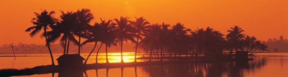
Anjengo Fort
Anjengo Fort is located about 36 Kms north of Thiruvananthapuram, near the famed beach of Varkala, and lying on the seacoast is Anjengo or Anjuthengu, meaning five coconut trees. A place of historic importance as well as beautiful natural setting, Anjengo is an ideal destination for those who don't mind walking around and explore what is in store.
The historic significance tagged to Anjengo comes through foreign powers like the Portuguese, the Dutch and finally the English East India Company. In the year 1684, the English East India Company chose Anjengo to establish their first trade settlement in Kerala. Following the English East India Company's presence, the place came to be known as Anjengo, meaning five coconut trees. According to local folk, the name Anjengo owes its genesis to a small area of land with five coconut trees, which was given on lease to the English East India Company by the then Queen of Attingal for trade purposes.
At Anjengo, one can find the remnants of the old English Fort, which was targeted several times by other foreign powers, who were at that time fighting each other to get a firm footing in Kerala. The Fort is now under the protection of National Heritage Monuments. There is also a cemetery inside the fort, which most probably would be having the remains of the occupants of the fort, and the oldest among the burial sites dates to 1704.
The backwater stretch here at Anjengo, and the avenue of coconut trees that crisscross the water channels are indeed a sight to behold. Another attraction at Anjengo is the serene beach, which is very clean and ideal for picnickers. The fishing village adjoining the beach adds to the overall charm of Anjengo, with the fishermen and their routine activities adding to one's interest.